Tools for location analysis and data visualization
1. CARTO
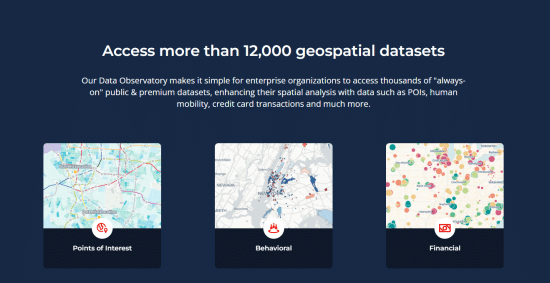
Whether you are a data analyst just starting out in location analysis or a data scientist creating machine learning-driven spatial models, CARTO's services (including geocoding, routing, isolation lines, and basemaps) can accelerate the process. Visualization should be more than just pretty maps, it should answer a specific question. CARTO performs spatial analysis of data with access to over 12,000 geospatial datasets that can be analyzed for financial resources, people movement, environment, population, road traffic, regions, points of interest, and behavior.
URL: https://carto.com/

2. Aspectum
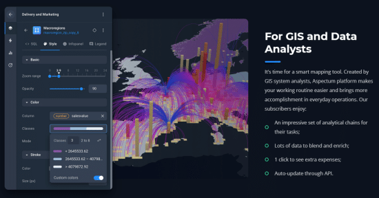
Data visualization: map mapping, publishing, sharing.
Data editing: capabilitities to edit the number of attributes and fence data.
Data analysis: algorithmic analysis capabilities to discover new in data.
Components: application tools and data analysis interaction components.
URL: https://aspectum.com/

3. Locale
An operational tool based on location analysis. Enables real-time alerts and issue management, saving you from putting out fires in reports and dashboards.
URL: https://www.locale.ai/

【Artificial Intelligence】●Advanced tips for using ChatGPT-4
銆怤ews銆戔棌Access control giant hit by ransom attack, NATO, Alibaba, Thales and others affected
【Open Source Intelligence】●10 core professional competencies for intelligence analysts
銆怰esources銆戔棌The 27 most popular AI Tools in 2023
【Dark Web】●5 Awesome Dark Web Links
【Web Intelligence Monitoring】●Advantages of open source intelligence
銆怤etwork Security銆戔棌9 popular malicious Chrome extensions
【News】●AI-generated fake image of Pentagon explosion goes viral on Twitter


