Integration of Artificial Intelligence into the US Intelligence System: An Analysis of the Current Situation of Artificial Intelligence Enhancing Geospatial Intelligence
The United States Imagery and Geospatial System believes that artificial intelligence can have an impact on human-intensive task analysis, target identification, task automation, geospatial intelligence agent training, and methodological research to advance intelligence technology.

The National Imagery and Mapping Agency (NIMA), the predecessor of the National
Geospatial-Intelligence Agency(NGA), began researching AI solutions in imagery
intelligence very early on. NIMA research shows that establishing accurate and
timely situational awareness is critical during mission execution. Artificial
intelligence can integrate the available information of the target area into a
situation map, generate 2D or 3D images and realize the construction of a dynamic
common operating picture (COP).
In addition, many artificial intelligence
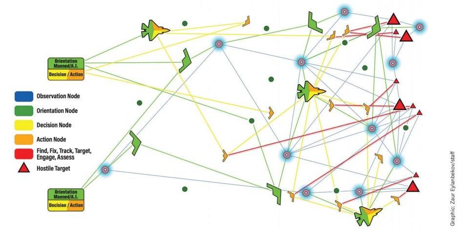
projects of the Defense Advanced Research Projects Agency (DARPA) are also closely
related to automatic target recognition and geospatial target analysis. DARPA
released the Moving Target Recognition program in July 2020. Its purpose is to solve
the problem of using synthetic aperture radar (SAR) to detect, image and geolocate
ground moving targets by developing processing algorithms and collection
technologies. The Moving Target Recognition project is a significant one for the
Agency’s Strategic Technology Office, the significance of the project comes from the
Agency’s Mosaic Warfare vision.

Change detection is another great application of artificial intelligence in
geospatial intelligence.
Traditionally, interpreting and analyzing satellite
images of global targets sent back every day and generating intelligence reports is
the most basic daily work of NGA image analysts, which usually requires a lot of
human resources. But by learning from historical patterns, current trends and
dynamic factors such as weather and adversarial behavior, AI can improve the ability
to predict target behavior, helping to determine the most appropriate methods and
locations to deploy assets for surveillance.
In other words, for fixed
targets such as military and industrial facilities in the target country, by
improving the artificial intelligence change detection algorithm, the machine can
independently complete most of the monitoring and screening work, helping image
analysts prioritize high-value images, find target objects, identify abnormal
activities, monitor changes in target facilities, and finally realize automatic
early warning based on images.
At present, the software used to assist image
analysis has developed from correction, storage and labeling functions to
intelligent interpretation software that can quickly identify and detect a large
number of images.
In the face of image data from heterogeneous and
multi-platform, intelligence agencies need to invest a lot of resources in
processing and analysis. Today, however, state-of-the-art automated image analysis
software can combine disparate datasets from different providers, including
attributes such as different resolutions, coordinate systems, and multiple spectral
bands.
However, at the moment when the development of artificial
intelligence technology is not yet perfect, the positioning of artificial
intelligence in geospatial intelligence is still controversial. There is no exact
way to solve the problem of discrepancy between artificial intelligence and analyst
analysis results. Therefore, deepening data mining, automatic identification and
data visualization and other auxiliary analysis intelligence enhancement means is
the main development direction of artificial intelligence in the field of geospatial
intelligence.