How open source intelligence investigations capture environmental risk?
Open source intelligence investigations often involve unfamiliar environments, such
as exotic street scenes in photographs, unknown fires in videos, or unknown group
conflicts in unknown locations. With limited background information, some
environmental investigation tools can help investigators quickly understand the
location, time, and risk. In this article, we will introduce three open source
intelligence environmental investigation tools.
1. EarthCam: Global
camera live images
https://www.earthcam.com/
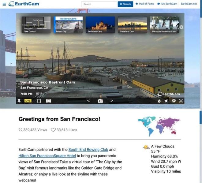
The EarthCam website brings together thousands of webcam live images,
allowing users to freely explore different locations, get relevant information on
weather, popular attractions, etc., and also take online virtual tours of some
popular locations to familiarize themselves with the local environment.
The
image below shows a live image of San Francisco Bay with related information.
2. RSOE: Emergency and disaster information system
https://rsoe-edis.org/eventMap
The RSOE system, operated by The Hungarian National Association of Radio
Distress-Signaling and Infocommunications, provides organizations, governments, and
the media with rapid access to highly credible data to monitor, record and analyze
all types of emergencies that occur around the world. Users can access the latest
information on disasters and alerts from around the world in the system.
RSOE
provides information on biological disasters, emergencies involving critical
infrastructure (e.g., traffic disruptions), social events (e.g., local security
conflicts, public safety incidents, demonstrations, terrorist activities, wars),
ecological disasters (e.g., environmental pollution, natural disasters), geological
disasters (e.g., earthquakes, landslides), hydrological observations (e.g.,
tsunamis), industrial accidents (e.g., building collapses), nuclear accidents,
traffic accidents, security alerts, and weather alerts, traffic accidents, security
alerts, weather warnings, etc.
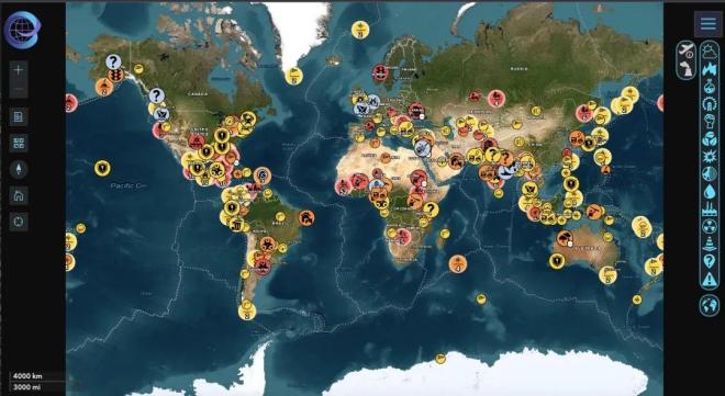
RSOE provides real-time maps of global
emergencies, with different icons representing different types of emergencies.
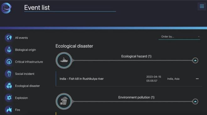
In addition, RSOE provides users with a list of emergencies, i.e., a text version of the map data at:
3. Risk Map: Global security risk map library
https://www.riskmap.com/
The
Risk Map platform obtains data from various global media channels, continuously
monitors information sources, and presents risk events around the world to users in
a real-time map.
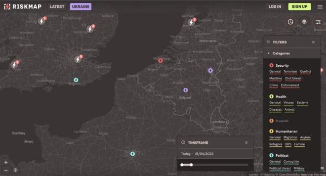
Different icons in the map represent different risks and events. Users can select the
time period to be monitored in the Timeframe window.
The Risk Map
categorizes the information provided, including categories such as security, health,
threats, humanitarian, and political. Through the Filters window, users can filter
the information according to their needs.
In addition, Risk Map also
provides users with a textualized version of real-time intelligence, providing an
overview of all emergencies.
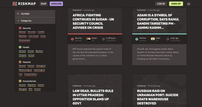
The summary of a specific incident includes the type of incident, where and when it occurred, and the main elements of the incident, helping users to quickly understand the situation and assess the risk.