OSINT Image Location: Empowering Intelligence Communities in the US and Middle East
In an era defined by information overload, the ability to pinpoint the location of an image has become a critical capability for intelligence professionals. Open-Source Intelligence (OSINT) tools, such as those provided by Knowlesys, are revolutionizing how analysts in the United States and the Middle East extract actionable insights from visual data. This article explores the significance of OSINT image location, its applications in addressing pressing intelligence concerns, and how Knowlesys empowers analysts to stay ahead in a complex geopolitical landscape.
The Growing Importance of OSINT Image Location
Images shared on social media, news outlets, or other public platforms often contain valuable intelligence. From tracking terrorist activities to monitoring regional conflicts, geolocating an image can reveal where an event occurred, providing context to otherwise ambiguous data. For intelligence communities in the US and Middle East, where real-time situational awareness is paramount, OSINT image location tools are indispensable.
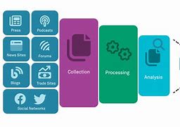
Knowlesys offers advanced OSINT monitoring systems that integrate image geolocation capabilities, enabling analysts to cross-reference visual data with other open-source information. By leveraging metadata, visual landmarks, and machine learning algorithms, these tools can accurately identify the location of an image, even when traditional markers are absent.
Key Applications for Intelligence Communities
The ability to geolocate images addresses several critical issues faced by intelligence professionals in the US and Middle East. Below are some key applications:
1. Counterterrorism and Threat Monitoring
In the Middle East, where groups like ISIS and Al-Qaeda continue to exploit social media for propaganda, geolocating images can help identify the origin of recruitment materials or verify claims of attacks. For example, an image of a training camp shared online can be geolocated to a specific region, enabling targeted counterterrorism operations. In the US, domestic threats, such as extremist groups, also rely on visual content to spread their message, making OSINT image location a vital tool for homeland security.
Knowlesys’s platforms streamline this process by automating image analysis and integrating it with broader OSINT data, such as social media posts and web content, to provide a comprehensive threat assessment.
2. Conflict Zone Analysis
Ongoing conflicts in regions like Syria, Yemen, and Iraq generate a flood of images, from civilian reports to military operations. Geolocating these images helps intelligence agencies verify the authenticity of claims, track troop movements, or assess the impact of airstrikes. For US analysts monitoring Middle Eastern conflicts, this capability is crucial for understanding the ground reality and informing policy decisions.
Knowlesys’s OSINT systems enhance conflict zone analysis by combining image geolocation with real-time data aggregation, ensuring analysts have a holistic view of dynamic situations.
3. Disinformation and Propaganda Detection
Both the US and Middle East face challenges from disinformation campaigns, where images are often manipulated or misattributed to mislead audiences. Geolocating images can debunk false narratives by confirming or refuting their claimed origins. For instance, an image purporting to show a recent event in a Middle Eastern city can be verified through OSINT tools to ensure it wasn’t recycled from an older incident.
Knowlesys’s advanced analytics help intelligence professionals identify manipulated images and trace their sources, strengthening efforts to combat disinformation.
Why Knowlesys Stands Out
Knowlesys is a leader in OSINT monitoring, offering tailored solutions for intelligence communities. Its platforms are designed to handle the unique challenges of image geolocation, including:
- Automation and Scalability: Knowlesys’s tools process vast amounts of visual data quickly, reducing the time analysts spend on manual verification.
- Integration with Broader OSINT: Image geolocation is combined with social media monitoring, web scraping, and other data sources for a 360-degree intelligence picture.
- User-Friendly Interface: Designed with intelligence professionals in mind, Knowlesys’s systems are intuitive, allowing analysts to focus on insights rather than technical complexities.
By addressing the specific needs of US and Middle Eastern intelligence communities, Knowlesys ensures its tools are both practical and impactful.
Challenges and Future Directions
Despite its potential, OSINT image location faces challenges, such as the increasing sophistication of image manipulation techniques and the removal of metadata by social media platforms. Intelligence communities must also navigate ethical considerations, ensuring that OSINT practices respect privacy and legal boundaries.
Looking ahead, advancements in artificial intelligence and machine learning will further enhance image geolocation capabilities. Knowlesys is at the forefront of these developments, continuously updating its platforms to incorporate cutting-edge technologies and address emerging threats.
Conclusion
OSINT image location is a game-changer for intelligence communities in the US and Middle East, offering unparalleled insights into counterterrorism, conflict analysis, and disinformation detection. With Knowlesys leading the way, analysts have access to powerful tools that combine automation, integration, and usability to tackle today’s most pressing challenges. As the intelligence landscape evolves, Knowlesys remains committed to empowering professionals with the OSINT solutions they need to safeguard national and regional security.